Project Description
Local governments are experiencing significant challenges with planning for growth and development while also protecting critical areas. While there are a number of modeling and mapping tools available to help with the planning process, the tools have not been integrated to provide for efficient, balanced, and comprehensive planning. In addition, planners are often unaware of all the tools that exist and lack the capacity and/or expertise to put them together in support of decision processes.
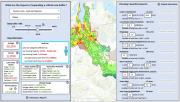
In 2019, Commerce researched the feasibility of developing a new web-based decision support tool to aid local planners in evaluating multiple planning scenarios and parameters for comprehensive land use planning in the Puget Sound region. Such a tool could integrate existing maps, models, and datasets to allow users to view and analyze the relationships between multiple points of interest. It would also include a web interface that allows planners to use datasets for decision making and assess alternative land use planning scenarios.
Prior to tool development, Commerce wanted to ensure that efforts would be worthwhile and achievable, and that we fully considered the associated barriers and risks in a prospectus.
Project Accomplishments
Commerce produced a prospectus report that defines the concept for the tool and shows that its development is achievable and needed. Our efforts to research and collaborate on prospectus development included the following:
- Collaborated with 135 stakeholders from 64 organizations to develop a conceptual design that meets needs of local jurisdictions, resource agencies, and stakeholders, including assembling a 50-member advisory committee.
- Identified and addressed potential barriers to tool development.
- Reviewed over 40 similar products and interviewed five tool developers whose platforms could be used to build the tool.
- Identified more than 15 contractors with the experience and expertise to develop the tool.
- Interviewed the developers of seven resource agency models to learn about the logistics of integrating multiple tools.
- Interviewed three local planning advisors to ensure that the concept aligns with their jurisdictions’ needs and learn about the logistics of integrating local data.
- Presented the project to multiple audiences to garner support for tool development.
Through this effort we were able to develop a thorough and well-researched prospectus that conceptualizes the proposed tool, presents the priority needs of users, and demonstrates that technologies, consultants, and institutions are available to help guide and develop the tool moving forward.
The prospectus thoroughly documents the vision for the tool, its key features based on our assessment of end user needs, tool architecture and key data sources, maintenance considerations and plans, target end users and how they can use the tool to support specific planning processes, a phased tool development process, a business architecture and project management structure, and solutions to potential barriers and risks. With assistance from a large advisory committee of experts, agencies, and end users, we have successfully developed a clear concept of the design features, analyses, and decisions the tool should be able to support to maximize benefits for planners, and an achievable plan for moving forward with tool development in a way that minimizes risks and resolves barriers.
Through our work researching and developing the prospectus, we found that 1) there is significant demand for the proposed tool from more than 100 stakeholders, 2) there are existing platforms that we can build upon for tool development, and 3) there are skilled contractors that can be utilized to build the tool. The technology and data needed to build the tool are readily available and we have developed solutions to mitigate and address risks and barriers. We have carefully considered the need for and benefits of the tool alongside the remaining risks and barriers, and concluded that tool development is both worthwhile and achievable.
Providing this tool for local planners would improve decision making by allowing better integration of critical areas planning with other comprehensive planning elements, improving access to and use of best available science, and allowing planners to show their work and justify decisions for stakeholders and reviewers. Integration of maps and models that show impacts on water quality, hydrology, ecosystem services, and other key environmental factors under various land use scenarios will facilitate better planning for development, protection, and restoration at the watershed scale, which will ultimately benefit Puget Sound recovery goals.
Next Steps
Our results indicate that tool development is feasible and timely, and that operational processes are in place to successfully move on to tool development. Once funding is secured, we can proceed to framing the tool, compiling and assessing data, and building and beta-testing a tool that brings together data and provides initial limited scenario analysis functionality. Then, we will pursue full build-out of the tool in the second phase, along with developing a plan for ongoing support and maintenance, and a training and marketing program to encourage use of the tool by local governments. Our partner agencies and large advisory committee of experts and end users have committed to continue providing support and guidance through this process. The final product will be a fully functional web-based spatial decision support system capable of supporting multiple land use planning decision processes, and to which additional scenario analysis functionality can be added in future updates. Then we will seek funding to implement a pilot project with a local jurisdiction, so that we can learn from actual use of the tool during comprehensive planning and develop guidance materials for use of the tool. We hope to receive funding to complete development and rollout of the tool through the Puget Sound Partnership and EPA’s funding mechanisms.
|

Please Wait...