| Local Flood Relief Project | Jurisdiction | Status | Start Date |
|---|---|---|---|
| Aberdeen -- Fry Creek Restoration | City of Aberdeen | Active - anticipated completion Fall 2024 | |
| Aberdeen -- Hoquiam -- North Shore Levee Project | City of Aberdeen (Partner w/ City of Hoquiam) | Active | 07/26/2013 |
| Hoquiam -- North Shore Levee- West Project | City of Hoquiam | Active | 07/26/2013 |
| Aberdeen -- Southside Dike/Levee Certification Project | City of Aberdeen | Active | 04/04/2013 |
| Timberworks Coastal Resiliency Master Plan | Aberdeen/Hoquiam/Grays Harbor County | Completed (Related Project) |
The Aberdeen-Hoquiam Flood Protection Project is comprised of two critical levees, the North Shore Levee and the North Shore Levee –West Segment, which are needed to protect the Cities of Aberdeen & Hoquiam.
Coordinated Coastal Resiliency Planning
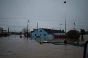
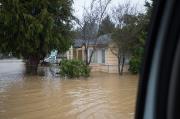
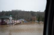
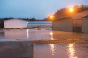
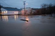
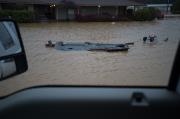
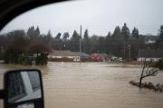
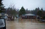
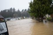
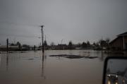
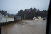
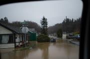
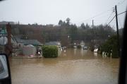
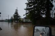
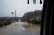
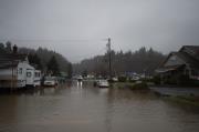
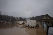
The Cities of Aberdeen and Hoquiam are working together on coordinated approach to reduce flooding, promote community development, and support salmon recovery efforts. The Cities are following a two-pronged approach to implement the Coastal Resiliency Master Plan and design / construct a protective levee system. The communities are impacted by a complex interaction of different types of flooding:
- Coastal flooding—driven by the combination of high tides, low pressure, and strong winds. This is the highest flood source and the primary factor in determining the FEMA flood zones.
- Riverine flooding—interactions of elevated flows in the Chehalis, Wishkah, and Hoquiam Rivers
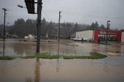
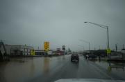
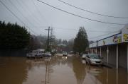
- Small drainage flooding—occurs when urbanized, straightened streams overtop their banks during high rainfall events.
- Localized flooding—excessive rain events overwhelm the stormwater drainage system.
These local efforts align with the regional work of the Chehalis River Basin Flood Authority resulting in both a Master Plan and preliminary design and approval of a levee system.
North Shore Levee
The North Shore Levee project will construct a 6.2 mile levee across the two cities, providing critical flood protection and removing over 3,100 properties from FEMA's mapped Special Flood Hazard Area. The project will build resiliency in the face of future flood events, retaining existing businesses, jobs, and residents which have been on the decline in the community. The total construction cost of the North Shore Levee is estimated to be approximately $78 million.
The North Shore Levee—West Segment project, estimated to cost $40 million to construct, will build a 4.7 mile levee (earthen, concrete and sheet pile) bordering the west side of Hoquiam. This levee will protect local residents and build resiliency in the face of future flood events, as well as retain existing businesses, jobs and residents which have been on the decline in this community. More information on North Shore Levee - West can be found at:
The public can submit comments and questions by going to https://www.surveymonkey.com/r/levee and filling out the online form. This can also be done at the second floor of Aberdeen City Hall using a workstation. Paper forms for submitting written comments and questions are also available at the second floor of Aberdeen City Hall and at Hoquiam City Hall.
May 2023 Update
Construction on the Fry Creek Pump Station is progressing. Based upon the current construction schedule, it is anticipated that the project will be completed in early 2024.
September 2022 Update
The Fry Creek Restoration and Pump Station design is complete and funding in hand- targeted to start construction fall 2022
After many years of ongoing work, funding coordination, and design work, the team leading the City of Aberdeen's overall flood relief efforts is making progress on the Fry Creek Restoration project and associated pump station.
It is anticipated that the Fry Creek Pump Station will start construction in Fall 2022. The Restoration project is still in final design pending final right of way acquitions that have delayed the implementation of the project. The Fry Creek restoration project and pump station will improve the storm drainage systems in Aberdeen and Hoquiam so that they more effectively collect and transport runoff from heavy rain events, and significantly reduce the economic burden on the community caused by flooding. In addition to providing flood relief, these projects will also positively impact pedestrian mobility and wildlife habitat in the area.
About The Fry Creek Restoration Project
As the cities have developed and changed over time, the Fry Creek channel, which runs along the boundary between Hoquiam and Aberdeen from Cherry Street south to Pacific Avenue, has been constricted. Today, the creek is a narrow channel passing through many culverts and under roadway crossings. The Fry Creek restoration project aims to restore the creek to a more natural state so the creek can manage heavy rain events and reduce street flooding. Design elements will also include pedestrian improvements to encourage walking and enjoyment of the restored area.
Restoration project elements include:
- Daylighting the creek by removing the underground culverts and street crossings at Aberdeen Avenue.
- Building a pedestrian bridge at Aberdeen Avenue
- Replacing the existing culvert at Pacific Avenue with a larger culvert that will reduce flooding and provide for better fish passage.
- Building a pedestrian walkway connecting Pacific and Aberdeen avenues
- Native plantings along Fry Creek
Past Activities
- April 2018 -- North Shore Levee Open House April 21 2018
Cities of Aberdeen and Hoquiam are hosting an open house to update the community on progress and next steps for design and construction of the North Shore Levee. The public is encouraged to attend to learn about the project, ask questions, and provide feedback. City staff and members of the Levee's design team will be on-hand and available.
COMMUNITY OPEN HOUSE
Saturday, April 21, 2018
10:00am - Noon
Rotary Log Pavilion
1401 Sargent Blvd, Aberdeen
- April 2018 -- New Online Option for Submitting North Shore Levee Comments and Questions
The public can submit comments and questions by going to https://www.surveymonkey.com/r/levee and filling out the online form. This can also be done at the second floor of Aberdeen City Hall using a workstation. Paper forms for submitting written comments and questions are also available at the second floor of Aberdeen City Hall.
- March 2018 -- Cities of Aberdeen and Hoquiam Receive $2.5 Million to Fund North Shore Levee Design
The Washington State Legislature approved a 2018 supplemental capital budget that includes $2.5 million for the Aberdeen-Hoquiam North Shore Levee project. With $2.1 million previously funded by the Chehalis River Basin Flood Authority, the project now has a total of $4.6 million in State funding, the full amount needed to complete design and permitting. This funding allows the project to stay on schedule for developing cost estimates in 2018 in time to make a 2019-2021 capital budget request for construction funding. Design is scheduled to be complete in 2019.
Once the Levee is constructed and accredited, over 3,100 properties in Aberdeen and Hoquiam, including Downtown Aberdeen, will be removed from the area that the Federal Emergency Management Agency (FEMA) has mapped as Special Flood Hazard Area (SFHA) due to coastal flood risk. Properties removed from the SFHA will no longer be subject to National Flood Insurance Program building code and flood insurance regulations, financial burdens that cost the community millions each year and hinder local investment. FEMA issued a preliminary approval for the proposed mapping change in October 2017 through a Conditional Letter of Map Revision.
The North Shore Levee project includes 5.7 miles of levee between the Wishkah and Hoquiam Rivers to protect against coastal flood events, plus significant upgrades to and expansion of stormwater pump systems to improve drainage. As the project prepares to transition to the next phase of design and permitting, the Cities will continue to engage and inform the community through community meetings, stakeholder interviews, personal meetings, surveys, website updates, council meeting updates, and media releases.
The Cities of Aberdeen and Hoquiam are committed to implementing the recommendations of the 2016 TimberWorks Master Plan. The Master Plan identified investments to reduce flood risk while also achieving other benefits such as water quality improvements and habitat enhancement, as well as community and economic development. In addition to the North Shore Levee, the Fry Creek Restoration & Flood Reduction project is a major TimberWorks project that is currently underway.
Statements from our Leadership:
Aberdeen Mayor Erik Larson:
I am very thankful for the Legislature's continued support for the North Shore Levee and other important infrastructure projects in both Aberdeen and Hoquiam, as well as the rest of Grays Harbor. We are a community worth investing in and the legislature continues to acknowledge this fact.
Hoquiam Mayor Jasmine Dickhoff:
We are ecstatic to know that the Legislature believes in this project enough to allocate the amount they did. Our sincere thanks to them and specifically to Rep. Brian Blake for championing our area at such a high degree of success.
Representative Brian Blake:
“This historic project will protect families across Aberdeen andHoquiam from floods, and will also protect and create jobs in the area,which will boost the economy,” said Rep. Brian Blake, D-Aberdeen, who made the capital budget request and secured the needed funds. “It’s a win-win, really, for everybody, and it will benefit Grays Harbor well into the future.”
- December 2017 -- Fry Creek First Phase Identified, Final Design of First Phase Underway
The Preliminary Design Report for the Fry Creek Restoration & Flood Reduction project was completed in August 2017. The Report identifies design and phasing alternatives for the lower creek system. Based on the Report's findings, the first phase of the project was selected to be the creek between Simpson Avenue and the railroad tracks. Final design of the first phase is currently underway. Funding for construction ($2.215 million) is included in the State's 2017-2019 biennium capital budget through the Washington Coast Restoration Initiative.
- October 2017 -- CLOMR Issued for North Shore Levee
The Federal Emergency Management Agency (FEMA) has issued a Conditional Letter of Map Revision (CLOMR) for the proposed North Shore Levee. FEMA’s issuance of a CLOMR is confirmation that, once the levee is built and certified, FEMA will redraw local Flood Insurance Rate Maps (FIRMs) to reflect levee protection. Within the limits of levee protection, areas that are currently mapped Special Flood Hazard Area (SFHA) due to coastal flooding will be removed from the 100-year coastal floodplain and remapped as Zone X. This is a major milestone for the North Shore Levee project as it ensures that the project, once constructed, will result in the intended mapping changes
The Cities of Aberdeen and Hoquiam are working in partnership to design and build the North Shore Levee to provide flood protection for low-lying parts of the cities between the Wishkah and Hoquiam Rivers north of the Chehalis River and Grays Harbor Estuary. The project will provide coastal flood protection to as many areas as is feasible, improve the storm drainage systems in Aberdeen and Hoquiam so that they more effectively collect and convey runoff from intense storm events, and significantly reduce the economic burden on the community caused by flooding. The FIRM mapping revisions associated with the Levee will remove approximately 3,500 properties between the Wishkah and Hoquiam Rivers from the SFHA and place them into a Zone X, eliminating Federal flood insurance requirements on mortgages.
The next step in this process is to finalize the design of the Levee and go through the local permitting process. Funding to continue design and permitting has been allocated by the Chehalis River Basin Flood Authority for the 2017-2019 biennium and will be available once the State passes a capital budget.
- October 2017 -- CLOMR Application Uploaded to North Shore Levee Website
The CLOMR application documents have been uploaded to the North Shore Levee project website and can be found by clicking on the "Library" heading.
Contact:
www.ezview.gov/chehalisfloodauthority

Please Wait...

